Most phones and many cameras save the latitude and longitude where a photo was taken inside the photo file. You can read it from one photo with the tools already on your phone or computer, or from a whole folder at once with the Photo GPS Extractor.
The quick way: any number of photos
- Open the Photo GPS Extractor.
- Drop in your photos. For a whole folder, open it, select all the photos and drag them in.
- Read the table: latitude, longitude, altitude, date taken and camera for every photo.
- Download the list as CSV for a spreadsheet, or as KML, GPX or GeoJSON for mapping.
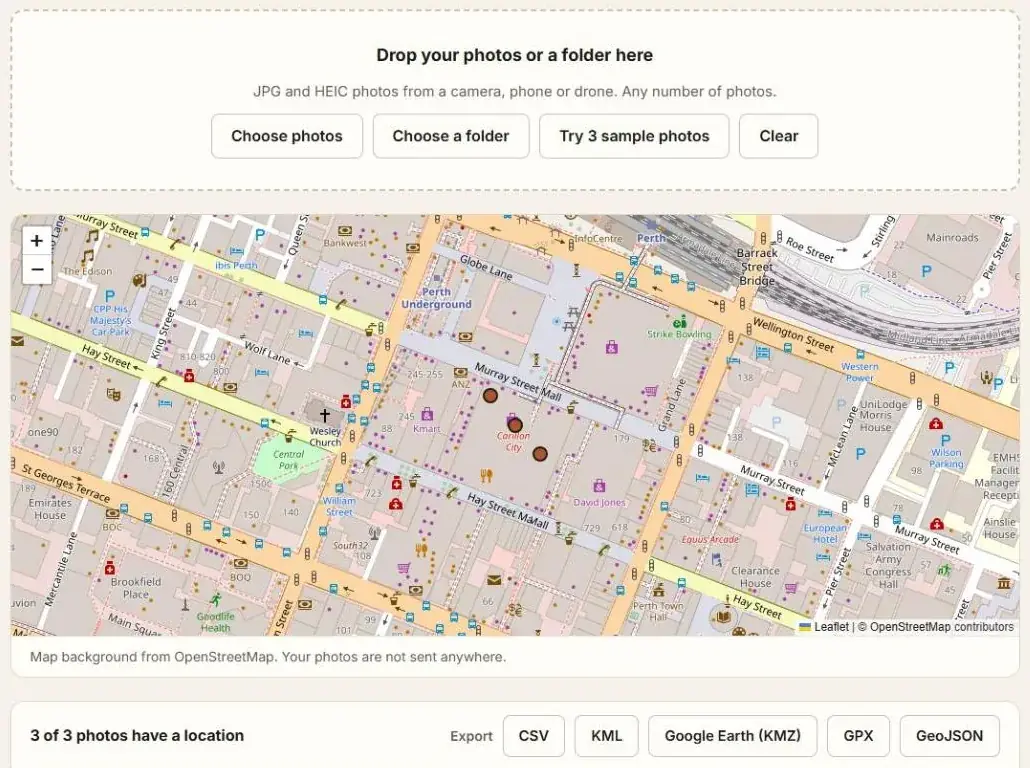
The photos are read in your browser on your own device. They are not uploaded. The tool reads JPG and HEIC photos.
To see the same photos on a map, read How to View Geotagged Photos on a Map.
One photo, without any tool
| Device | Where to look | What you see |
|---|---|---|
| Windows | Right-click the photo, Properties, Details, then the GPS section | Latitude, longitude and altitude |
| Mac | Open in Preview, Tools, Show Inspector, GPS tab | Coordinates and a small map |
| iPhone | Open the photo and swipe up | The place on a map |
| Android (Google Photos) | Open the photo and swipe up | A map with the coordinates under it |
This is fine for one or two photos. For more, typing coordinates out by hand is slow and easy to get wrong.
A whole folder into a spreadsheet
Download CSV and open it in Excel or Google Sheets. It has one row for each photo that has a location: file name, latitude and longitude in decimal degrees, altitude, date taken and camera. Photos with no location are marked in the table on the page, so you can see which ones are missing.
To change the coordinates into another format, such as UTM or MGRS, paste the latitude and longitude columns into the Coordinate Converter.
When a photo has no coordinates
- Location was switched off for the camera app when the photo was taken.
- The photo came through a messaging or social media app. Many of them remove location data.
- It is a screenshot, a scan or an edited export.
- The camera has no GPS.
Use the original file wherever you can. A copy sent through an app is often not the same file.
To put a location into photos that have none, see How to Add a GPS Location to Photos.
Questions
Can you find where a photo was taken if it has no GPS data?
Not with this method. These tools read the coordinates stored in the file. They do not work out a location from what the picture shows.
How accurate are the coordinates?
They are as accurate as the device's GPS at that moment. Outdoors with a clear sky that is usually within several metres. Indoors or between tall buildings it can be much worse.
Does it work with iPhone photos?
Yes. iPhones save photos as HEIC, or as JPG when the camera format is set to "Most Compatible". The Photo GPS Extractor reads both.
Is it safe for confidential photos?
The Photo GPS Extractor reads the photos on your own device and does not upload them. Its map background is loaded from OpenStreetMap, which receives the area you are viewing, not your photos.
Do I need ExifTool for this?
No. ExifTool can do it from the command line, and the Photo GPS Extractor does it in a browser window. For the other options, see Alternatives to ExifTool.