A drone or LiDAR point cloud usually covers more than the site you need: neighbouring blocks, roads, trees along the edge. Clipping it to the site boundary makes the file smaller, faster to open and easier to hand over. Draw the boundary on a map or load it from a KML or GeoJSON file, and save the points inside as a new LAS or LAZ file.
Clip the file
- Open Point Cloud Clipper.
- Drop the LAS or LAZ file onto the page. The points are read on your device and placed on the map.
- Check "The points are in". It is filled in from the file. If the file does not say, choose the system, such as MGA zone 50.
- Draw a rectangle or a shape on the map, or load the site boundary as a KML, KMZ or GeoJSON file.
- Check the estimate of how many points will be kept.
- Choose LAZ or LAS and press "Save the clipped file".
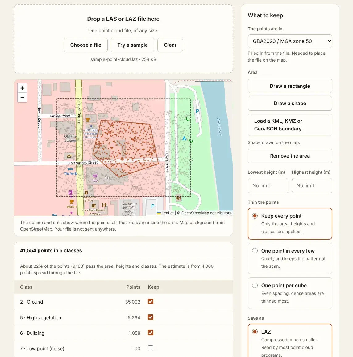
The file is read in parts, so a file of several gigabytes works. In Chrome and Edge the new file is written straight to disk.
How the boundary is matched to the points
A boundary drawn on a map or saved in a KML file is in degrees of latitude and longitude. Point clouds are usually in metres, in a grid such as MGA or UTM. The tool moves the boundary into the system of the point cloud, with each edge split into short steps so that it follows the same line, and then tests every point against it.
That is why the coordinate system must be known. A file with no system, or the wrong one, would put the boundary in the wrong place. How to fix the coordinate system of a point cloud shows how to check and set it first.
What the new file holds
- Every point inside the boundary, copied as it is: position, intensity, returns, class, GPS time and colour.
- The same coordinate system records as the original.
- A header with the new point count and extent.
You can also leave out heights and classes in the same pass, or thin the points. How to remove noise from a point cloud and how to thin a point cloud cover those.
Questions
Can the boundary have more than one area?
Yes. A KML or GeoJSON file with several polygons keeps the points inside any of them. Holes in a polygon are left out.
Where do I get a boundary file?
Draw it in Google Earth and save it as KML, export it from GIS or CAD software, or ask the client for the site boundary.
Is my original file changed?
No. You get a new file, named after the original with "-clipped" added.
Can I clip a file in degrees?
Yes. A point cloud in WGS 84, GDA94 or GDA2020 degrees is clipped the same way.