An orthomosaic from a drone mapping job is often one GeoTIFF of several gigabytes. It is slow to open, hard to email or upload, and too big for some programs. Storing the image with JPEG compression inside the GeoTIFF usually makes it five to ten times smaller while it stays in exactly the same place on the map.
Compress the file
- Open Orthomosaic Compressor.
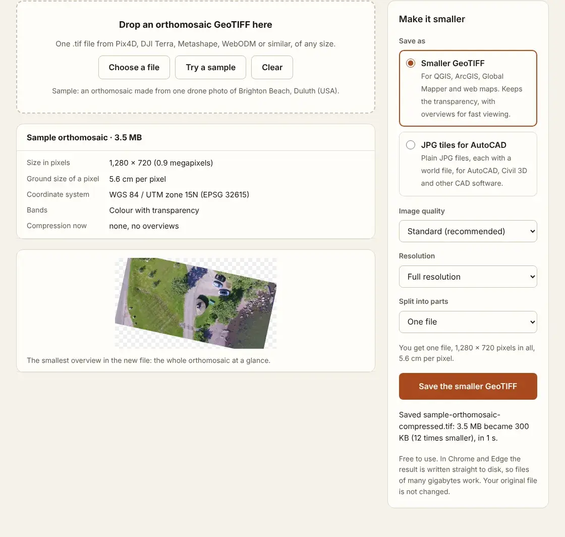
- Drop the orthomosaic .tif onto the page. Its size in pixels, the ground size of a pixel and the coordinate system are shown.
- Under "Save as", keep "Smaller GeoTIFF".
- Choose the image quality. Standard suits most work; high is hard to tell from the original.
- Leave the resolution at full, or choose half to make the file about four times smaller again.
- Press "Save the smaller GeoTIFF" and choose where it goes.
What changes in the file
| Part of the file | Before | After |
|---|---|---|
| Compression | Often LZW, Deflate or none | JPEG, the usual choice for aerial photos |
| Position and coordinate system | As written by the mapping software | The same |
| Transparent edges | A fourth band (alpha) | A mask inside the file, so the edges stay transparent |
| Overviews | Often none | Added, so the whole map opens at once |
A file under 4 GB is saved as a standard TIFF rather than a BigTIFF, which more programs can open. In Chrome and Edge the new file is written straight to disk as it is made, so orthomosaics of many gigabytes work.
Which quality to choose
JPEG drops detail the eye hardly sees. At the standard setting the colours of a 2.4 GB test orthomosaic changed by about 1.5 of 255 on average, and the file became 5.5 times smaller. Choose high quality for measurement work at full zoom, and small for previews and sharing. The original file is never changed, so you can try more than one.
If the file is still too big for the program it is going into, split it into parts or lower the resolution: an orthomosaic too large to open covers both. For CAD, see how to open a drone orthomosaic in AutoCAD.
Questions
Does it work for elevation models?
No. It takes colour orthomosaics (RGB, with or without transparency). A DSM or DTM holds heights, which JPEG compression would change.
Can I compress a file that is already JPEG-compressed?
Yes, but it shrinks less. Lowering the resolution or splitting it helps more.
Will QGIS read the new file?
Yes. QGIS, ArcGIS and Global Mapper all read JPEG-compressed GeoTIFFs with masks and overviews.