A drone video and the .SRT file saved beside it hold everything needed: the pictures, and the position for each moment. Load both into a tool that pairs them, choose how far apart the frames should be, and save the frames as JPG photos with the GPS position inside.
Save the frames
- Before the flight, switch on Video Subtitles in the DJI Fly app, so the drone saves a .SRT file. What a DJI SRT file is has the details.
- Copy the video and the .SRT file with the same name from the memory card.
- Open Video to Geotagged Frames.
- Drop both files onto the page.
- Choose the spacing: a frame every few seconds, or every few metres flown.
- Check the frames in the table and on the map.
- Press "Save the frames".
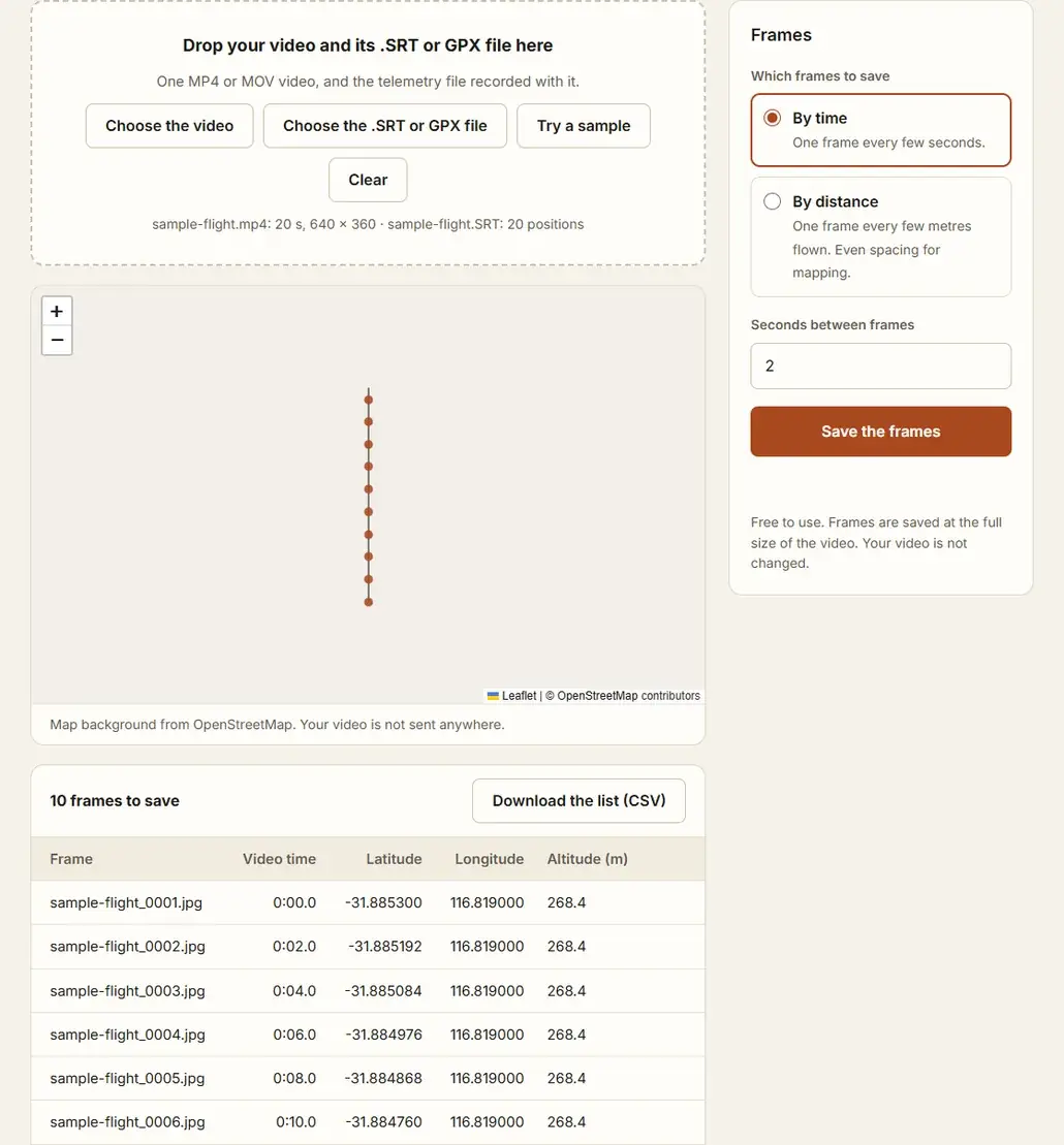
The video is opened by your browser on your own device. Nothing is uploaded.
Time or distance
| Spacing | Use it for |
|---|---|
| Every few seconds | A record of a flight, an inspection, a steady speed. |
| Every few metres | Mapping. The frames are evenly spaced on the ground, and a hover adds no extra frames. |
For mapping, the spacing decides the overlap between frames. How much overlap drone mapping photos need gives the figures to aim for. Can you make a map from drone video? covers what to expect from the result.
What you get
Each frame is a JPG at the full size of the video, named after the video with a number. Inside each one:
- the latitude and longitude of that moment
- the date and time, when the .SRT file records them
- the altitude, when the file gives a height above sea level
A CSV file lists every frame with its video time, position and height. A height above the take-off point is in the list only.
Check the result
Frames from video are softer than photos, and a fast pass blurs them. Load the saved frames into the Drone Flight Check to see spacing, overlap and blurred frames before you process them. How to check drone photos before processing walks through it.
Questions
Can I use a video from another camera?
Yes, with a GPX track recorded at the same time, from a phone or a GPS logger. Enter the moment the recording started and the tool finds the position of each frame on the track.
How exact are the positions?
As exact as the .SRT file. Newer DJI drones record a position for every frame. Older ones record one a second, to about ten metres.
Why does my video not open?
The browser has to be able to play it. H.264 video opens everywhere. H.265 (HEVC) video opens in Chrome, Edge and Safari on most recent devices.
Is the video changed?
No. The frames are new files. The video stays as it is.